
Mutyalapalem
This article includes a list of general references, but it lacks sufficient corresponding inline citations. (August 2015) |
Mutyalapalem | |
|---|---|
Village | |
 Dynamic map | |
.svg) Mutyalapalem Location in Andhra Pradesh, India | |
| Coordinates: 16°25′48″N 81°56′0″E / 16.43000°N 81.93333°E | |
| State | Andhra Pradesh |
| Region | Coastal Andhra |
| District | East Godavari |
| Talukha | Razole |
| Elevation | 5−25 m (−80 ft) |
| Population (2011) | |
| • Total | 1,000 |
| Languages | |
| • Official | Telugu |
| Time zone | UTC+5:30 (IST) |
| PIN | 533248 |
| Telephone code | 08862 |
| Parliament constituency | Amalapuram |
| Assembly constituency | Razole |
Mutyalapalem is a village in East Godavari district in the state of Andhra Pradesh, India.
Geography
Mutyalapalem covers around 412 acres, and has approximately 210 houses. The total population of the village is around 1000. Mutyalapalem is about 3 km (1.9 mi) from the Bay of Bengal. It is part of the Konaseema delta, a triangle formed by the waters of the Godavari River and the delta.
Gallery
-
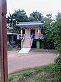 Ramalayam
 -
 Primary School
 -
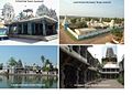 Near by Tourism Places


