
Donja Borina
Donja Borina
Доња Борина | |
|---|---|
 Donja Borina | |
| Coordinates: 44°26′N 19°09′E / 44.433°N 19.150°E | |
| Country | |
| Municipality | Mali Zvornik |
| Time zone | UTC+1 (CET) |
| • Summer (DST) | UTC+2 (CEST) |

Donja Borina (Serbian Cyrillic: Доња Борина) is a village in Serbia. It is situated in the Mali Zvornik municipality, in the Mačva District of Central Serbia. The village has a Serb ethnic majority and its population was 1,731 in 2002.

- 1948: 1,187
- 1953: 1,290
- 1961: 1,395
- 1971: 1,446
- 1981: 1,521
- 1991: 1,707
- 2002: 1,731[1]
| Year | Pop. | ±% |
|---|---|---|
| 1948 | 1,187 | — |
| 1953 | 1,290 | +8.7% |
| 1961 | 1,395 | +8.1% |
| 1971 | 1,446 | +3.7% |
| 1981 | 1,521 | +5.2% |
| 1991 | 1,707 | +12.2% |
| 2002 | 1,731 | +1.4% |
| 2011 | 1,523 | −12.0% |
| Source: [2] | ||
About village
Donja Borina consists of two major settlements Batar and Andraca. For any of them they do not know exactly how they got the name. Batar is much more urban than Andraca, there is a church, primary school, post and cultural center, where is the local administration.
Andraca is a part of the village where people are mostly deal with agriculture, limekiln and selling of timber. Other hamlets are: Dedinje, Stojanovici, Petkovici, Kikanovici, Pavlovici, Filipovici, Lepenica and Gucevo.
Popular Places
Certainly the most attractive part of the village is located near the Drina river, along which there are two restaurants.
-
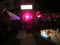 Donja Borina caffe Stella
 -
 Caffe Stella
 -
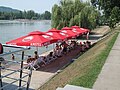 Drina´s beach
 -
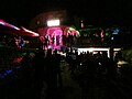
 Summer in Donja Borina
 -
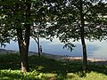
 Drina
Drina -
 Donja Borina-Street
 -
 Donja Borina-Restaurant Mladica
 -
 Drina river
 -
 Donja Borina-Post
 -
 Donja Borina-Church
 -
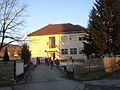 Primary school "Braca Ribar"


References
- ^ In Serbian Књига 9, Становништво, упоредни преглед броја становника 1948, 1953, 1961, 1971, 1981, 1991, 2002, подаци по насељима, Републички завод за статистику, Београд, мај 2004, ISBN 86-84433-14-9
- ^ "Comparative Overview of the Number of Population in 1948, 1953, 1961, 1971, 1981, 1991, 2002 and 2011: Data by Settlements" (PDF). stat.gov.rs. Statistical Office of the Republic of Serbia. April 2014. Retrieved 31 Jan 2021.
See also
44°26′N 19°09′E / 44.433°N 19.150°E