South Cambridgeshire
South Cambridgeshire District | |
|---|---|
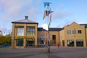
 Cambourne town centre | |
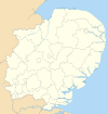
 South Cambridgeshire shown within Cambridgeshire | |
| Sovereign state | United Kingdom |
| Country | England |
| Region | East of England |
| Non-metropolitan county | Cambridgeshire |
| Status | Non-metropolitan district |
| Admin HQ | Cambourne |
| Incorporated | 1 April 1974 |
| Government | |
| • Type | Non-metropolitan district council |
| • Body | South Cambridgeshire District Council |
| • Leadership | Leader & Cabinet (Liberal Democrat) |
| • MPs | Anthony Browne (C) Lucy Frazer (C) |
| Area | |
| • Total | 348.12 sq mi (901.63 km2) |
| • Rank | 35th (of 296) |
| Population (2022) | |
| • Total | 165,633 |
| • Rank | 124th (of 296) |
| • Density | 480/sq mi (180/km2) |
| Ethnicity (2021) | |
| • Ethnic groups | |
| Religion (2021) | |
| • Religion | List
|
| Time zone | UTC0 (GMT) |
| • Summer (DST) | UTC+1 (BST) |
| ONS code | 12UG (ONS) E07000012 (GSS) |
| OS grid reference | TL318598 |
South Cambridgeshire is a local government district of Cambridgeshire, England, with a population of 162,119 at the 2021 census.[2] It was formed on 1 April 1974 by the merger of Chesterton Rural District and South Cambridgeshire Rural District. It completely surrounds the city of Cambridge, which is administered separately from the district by Cambridge City Council.
On the abolition of South Herefordshire and Hereford districts to form the unitary Herefordshire in 1998, South Cambridgeshire became the only English district to completely encircle another. South Cambridgeshire District Council and Cambridge City Council work together on some projects, such as the Greater Cambridge Local Plan.[3] Since 2017 the district has been a constituent member of the Cambridgeshire and Peterborough Combined Authority, led by the directly-elected Mayor of Cambridgeshire and Peterborough.[4]
South Cambridgeshire has scored highly on the best places to live, according to Channel 4, which ranked South Cambridgeshire as the fifth-best place to live in 2006.[5] A Halifax survey rated South Cambridgeshire the best place to live in rural Britain, and sixth best overall in 2017.[6]
In January 2023 the council started a three-month trial of a four day working week, with the intention of extending the trial until April 2024. Conservative local government minister, Lee Rowley, ordered the trial be halted, claiming it would breach the Local Government Act.[7][8]
History
The district was formed on 1 April 1974 under the Local Government Act 1972. The new district covered the area of two former districts, which were both abolished at the same time:[9]
The new district was named South Cambridgeshire, reflecting its position within the wider county.[10]
Governance
South Cambridgeshire District Council | |
|---|---|
 | |
| Type | |
| Type | |
| Leadership | |
Liz Watts since 2019[12] | |
| Structure | |
| Seats | 45 councillors |
Political groups |
|
| Elections | |
| Plurality-at-large | |
Last election | 5 May 2022 |
Next election | 7 May 2026 |
| Meeting place | |
 | |
| South Cambridgeshire Hall, Cambourne Business Park, Cambourne, CB23 6EA | |
| Website | |
| www | |

South Cambridgeshire District Council provides district-level services. County-level services are provided by Cambridgeshire County Council. The whole district is also covered by civil parishes, which form a third tier of local government.[13]
Political control
The council has been under Liberal Democrat majority control since the 2018 election.
The first election to the council was held in 1973, initially operating as a shadow authority alongside the outgoing authorities until the new arrangements came into effect on 1 April 1974. Political control of the council since 1974 has been as follows:[14]
| Party in control | Years | |
|---|---|---|
| Independent | 1974–1992 | |
| No overall control | 1992–2007 | |
| Conservative | 2007–2018 | |
| Liberal Democrats | 2018–present | |
Leadership
The leaders of the council since 2001 have been:[15]
| Councillor | Party | From | To | |
|---|---|---|---|---|
| Daphne Spink | Conservative | 17 May 2001 | 26 May 2005 | |
| Sebastian Kindersley | Liberal Democrats | 26 May 2005 | 25 May 2006 | |
| David Bard | Conservative | 25 May 2006 | 11 Jan 2007 | |
| Ray Manning | Conservative | 25 Jan 2007 | 19 May 2016 | |
| Peter Topping | Conservative | 19 May 2016 | 23 May 2018 | |
| Bridget Smith | Liberal Democrats | 23 May 2018 | ||
Composition
Following the 2022 election and subsequent by-elections and changes of allegiance up to June 2023, the composition of the council was:
| Party | Councillors | |
|---|---|---|
| Liberal Democrats | 35 | |
| Conservative | 9 | |
| Independent | 1 | |
| Total | 45 | |
The next election is due in 2026.
Elections
Since the last full review of boundaries in 2018 the council has comprised 45 councillors representing 26 wards, with each ward electing one, two or three councillors. Elections are held every four years.[16]
Premises
South Cambridgeshire District Council's headquarters are located in South Cambridgeshire Hall in the Cambourne Business Park in Cambourne.[17] The district council's headquarters moved from Cambridge to Cambourne in 2004.
Transportation
Cambridge Airport is located in South Cambridgeshire.[18]
The Cambridgeshire Guided Busway passes through South Cambridgeshire.
Economy
ScotAirways has its head office on the grounds of Cambridge Airport in South Cambridgeshire.[18][19]
Residents
Jenny Jefferies an author of several cook books and member of the Guild of Food Writers.
Parishes

The whole district is divided into civil parishes. The parish councils for Cambourne and Northstowe take the style "town council". Some of the smaller parishes have a parish meeting rather than a parish council.[20]
List of settlements

Abington Piggotts – Arrington – Babraham – Balsham – Bar Hill – Barrington – Bartlow – Barton – Bassingbourn cum Kneesworth – Bourn – Boxworth – Caldecote – Cambourne – Carlton – Castle Camps – Caxton – Childerley – Chishills – Chittering – Comberton – Conington – Coton – Cottenham – Croxton – Croydon – Dry Drayton – Duxford – Elsworth – Eltisley – Fen Ditton – Fen Drayton – Fowlmere – Foxton – Fulbourn – Gamlingay – Girton – Grantchester – Graveley – Great Abington – Great Eversden – Great Shelford – Great Wilbraham – Guilden Morden – Hardwick – Harlton – Harston – Haslingfield – Hatley – Hauxton – Heydon – Hildersham – Hinxton – Histon – Horseheath – Horningsea – Ickleton – Impington – Kingston – Knapwell – Landbeach – Linton – Litlington – Little Abington – Little Eversden – Little Gransden – Little Shelford – Little Wilbraham – Lolworth – Longstanton – Longstowe – Madingley – Melbourn – Meldreth – Milton – Newton – Oakington – Orchard Park – Orwell – Over – Pampisford – Papworth Everard – Papworth St Agnes – Rampton – Sawston – Shepreth – Shingay cum Wendy – Shudy Camps – Six Mile Bottom – Stapleford – Steeple Morden – Stow-cum-Quy – Swavesey – Tadlow – Teversham – Thriplow & Heathfield – Toft – Waterbeach – West Wickham – West Wratting – Weston Colville – Westwick – Whaddon – Whittlesford – Willingham – Wimpole
Arms
|
The council's coat of arms contains a tangential reference to the coat of arms of the University of Cambridge[22] by way of the coat of arms of Cambridge suburb Chesterton.[23] The motto, Niet Zonder Arbyt, means "Nothing Without Work" (or effort) in pre-standard Dutch; the only Dutch motto in British civic heraldry. It was originally the motto of Cornelius Vermuyden, who drained the Fens in the 17th century. The council uses a monochrome depiction of its coat of arms as its logo.
References
- ^ a b UK Census (2021). "2021 Census Area Profile – South Cambridgeshire Local Authority (E07000012)". Nomis. Office for National Statistics. Retrieved 5 January 2024.
- ^ "Non-Metropolitan District council population 2011". Neighbourhood Statistics. Office for National Statistics. Retrieved 13 July 2016.
- ^ "Greater Cambridge Local Plan". Greater Cambridge Shared Planning. Retrieved 14 June 2023.
- ^ "The Cambridgeshire and Peterborough Combined Authority Order 2017", legislation.gov.uk, The National Archives, SI 2017/251, retrieved 13 June 2023
- ^ "BEST AND WORST PLACES TO LIVE 2006". Channel 4. Archived from the original on 5 December 2006. Retrieved 1 June 2023.
- ^ "Halifax survey". MSN.[dead link]
- ^ "South Cambridgeshire Council 'first' to trial four-day working week". BBC News. 2 September 2022. Archived from the original on 2 September 2022. Retrieved 1 July 2023.
- ^ Hussen, Dahaba Ali (1 July 2023). "Minister orders halt to Cambridgeshire council's four-day week trial". The Guardian. ISSN 0261-3077. Archived from the original on 1 July 2023. Retrieved 1 July 2023.
- ^ "The English Non-metropolitan Districts (Definition) Order 1972", legislation.gov.uk, The National Archives, SI 1972/2039, retrieved 31 May 2023
- ^ "The English Non-metropolitan Districts (Names) Order 1973", legislation.gov.uk, The National Archives, SI 1973/551, retrieved 31 May 2023
- ^ "New cabinet unveiled at South Cambridgeshire District Council". South Cambridgeshire District Council. 23 May 2024. Retrieved 27 May 2024.
- ^ Hatton, Ben (4 July 2019). "South Cambridgeshire District Council appoint new chief executive". Cambridge Independent. Retrieved 14 June 2023.
- ^ "Local Government Act 1972", legislation.gov.uk, The National Archives, 1972 c. 70, retrieved 31 May 2023
- ^ "Compositions calculator". The Elections Centre. Retrieved 1 June 2023.
- ^ "Council minutes". South Cambridgeshire District Council. Retrieved 30 May 2022.
- ^ "The South Cambridgeshire (Electoral Changes) Order 2017", legislation.gov.uk, The National Archives, SI 2017/479, retrieved 14 June 2023
- ^ "How to find us Archived 23 October 2010 at the Wayback Machine." South Cambridgeshire. Retrieved on 6 June 2010.
- ^ a b "Local Plan 2004 map 27b – Cambridge Airport." South Cambridgeshire District Council. Retrieved on 6 July 2010.
- ^ "Contact Us." ScotAirways. Retrieved on 29 September 2009.
- ^ "Parish council contact details". South Cambridgeshire District Council. Retrieved 27 May 2024.
- ^ "SOUTH CAMBRIDGESHIRE DISTRICT COUNCIL". Robert Young. Retrieved 30 October 2019.
- ^ "South Cambs coat of arms".
- ^ "Chesterton coat of arms".

